10 beautiful satellite images from Google Earth: The miraculous arrangement of nature is worth a million dollars
Do you believe these are really pictures of Google Earth taken from our Earth-looking satellite?
If Google Maps is the most popular navigation map application on the planet, Google Earth is a tool for showing the rare landscapes from outer space looking at the Earth. Currently, the collection of satellite images in orbit has reached more than 2500 images in Google Earth data, and among them there is no shortage of fascinating works of art. If you have never had a life-altering work no less than the paintings from talented artists, do not regret taking a few minutes to look at the amazingly beautiful examples.
1. Brawley (USA)
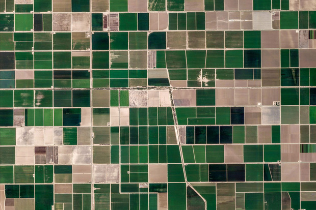
The town of Brawley in the US has a long history of raising cattle, creating a food feature for this place. Summer temperatures often reach 41 ° C), and the ground is below sea level.
2. Ajdabiya (Libya)
Ajdabiya is located in the northeast of Libya, along the Mediterranean. The city lies on an arid basin about 6.4 km from the sea, which is a location on an important route of the coastal road from Tripoli to Benghazi and from inland areas in the south to the Jalu Oasis. and east to Tobruk, a border city with Egypt.
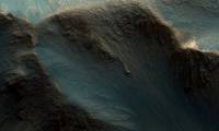
3. Nonning (Australia)

Nonning or Nonning Station is a familiar breeding ground in southern Australia, mainly for sheep and related production activities.
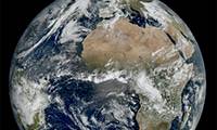
4. Antarctica

With an area of 14.2 million square kilometers, Antarctica is the fourth largest continent in the world, nearly double Australia. The percentage of people living here is just 0.0000 people / km2, with 98% of the area covered with ice and an average thickness of 1.9km. The lowest temperature ever recorded here was −94.7 ° C.
5. Zapotiltic (Mexico)

Zapotiltic is a town in the southern Mexican state of Jalisco, with a population of over 29,000 people.
6. Bockhorst (Germany)

Bockhorst is a municipality in the Emsland district, in the state of Niedersachsen, Germany. It has an area of only 18.19 km2.
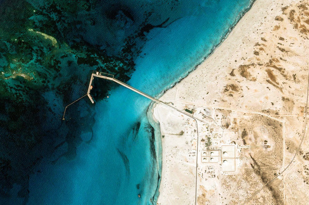
7. Jamnagar (India)

Jamnagar is the largest city on the west coast of India.
8. Karas Region (Namibia)

The Karas region is the southernmost region of Namibia, with the nation's most sparsely populated population in southern Africa.
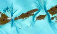
9. Exuma (Bahamas)

Exuma is a county of the Bahamas - a country in the Caribbean - consisting of more than 365 islands, also known as bays. The largest of the bays is the Great Exuma, which is nearly 60km long and is connected to another island, Little Exuma, by a small bridge. The capital and largest town in the district is George Town.
10. Al Fasher (Sudan)

Al Fasher is a county in North Darfur State, in the Sudan nation of Northern Africa.
Was this article helpful?
Your feedback helps us improve.
Related Articles
 10 beautiful satellite images from Google Earth2 minutes read
 Take a picture of what the Earth for Google Maps uses, where is it attached?4 minutes read
 How to Install Google Earth8 minutes read
 Google Maps has recorded 98% of human habitation on Earth2 minutes read
 ESA's new weather satellite sends back images of Earth with impressive detail3 minutes read
 NASA announces more than 1,000 latest Martian surface images3 minutes read
Reader Comments 0
Sign in with email or Google to join the discussion.