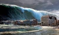
NASA's latest satellite imagery could change the definition of tsunamis.
The images captured by the spacecraft have revealed a previously unseen pattern that could be invaluable for understanding these deadly tsunamis.
Table of Contents
Tsunami physics has always been difficult to study, due to their infrequent occurrences and the dangers they pose. We can't simply walk into a tsunami to observe our surroundings. Therefore, it was a coincidence that just as a NASA satellite designed to observe ocean topography was flying overhead, a massive tsunami struck the Pacific Ocean. The images captured by the spacecraft revealed a previously unseen pattern that could be invaluable for understanding these deadly tsunamis.
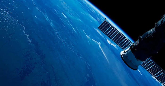
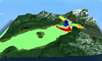
The satellite that took these images belongs to Surface Water and Ocean Topography (SWOT), a joint venture between NASA and the French space agency CNES. The satellite is equipped with a range of sensors (radar interferometer, GPS, laser reflector, and twin-beam microwave radiometer, among others) to measure changes in water surface elevation. After a tsunami occurred off the coast of Russia, this satellite captured images of it.
On July 29, 2025, an underwater earthquake off the Kamchatka Peninsula in southeastern Russia was recorded with a magnitude of 8.8 on the Richter scale. An underwater earthquake is like a child throwing a cannonball into a swimming pool, and the subsequent tsunami ripped through the Pacific Ocean with waves rising from the seabed to a height of 45 cm above sea level. The SWOT satellite, which happened to fly overhead just 70 minutes after the earthquake, captured images of the tsunami's movement. What it discovered seemed to immediately refute outdated models not only about tsunamis but also about water.
Water does not move as a single resource.
When examining high-resolution images captured by the SWOT satellite, the team of scientists noticed something that seemed to contradict what they thought they knew about these extreme weather events. Until now, it had been believed that tsunamis travel as a single force rather than a collection of many smaller waves – that is, non-dispersive, in academic terms. However, the SWOT data the scientists reviewed did not fit the non-dispersive model. As they wrote in a paper published by The Seismic Record, the data appeared to fit much more closely to the dispersive model. This means that the main wave is followed by a " chapel of waves ," or in other words, a series of smaller waves behind it.
With this new information, scientists hope they will be able to develop new models to more accurately identify, track, and predict tsunami patterns. This could lead to improvements not only in research but also in preparedness and safety in response to threats. In a quote from NASA, scientist Nadya Vinogradova Shiffer, head of the Earth and SWOT research group, said: " The power of SWOT's broad, brushstroke-like ocean-painting lies in providing crucial real-world confirmations, unlocking new physics knowledge, and marking a leap toward more accurate early warning and a safer future. "
Was this article helpful?
Your feedback helps us improve.
Related Articles
 10 beautiful satellite images from Google Earth2 minutes read
 Tsunami: the cause of terrible formation and destructive power that haunts mankind1 minutes read
 Science invented a tsunami simulation model caused by an earthquake3 minutes read
 Toshiba's price range from 12.5 million to Vietnam4 minutes read
 Toshiba Satellite 'changes blood'3 minutes read
 What is Starlink? How does satellite internet work?8 minutes read
Reader Comments 0
Sign in with email or Google to join the discussion.