Table of Contents
This updated guide explains how to Use Google Maps to Find Your Way through clear steps, practical examples, and important checks that help prevent common errors.
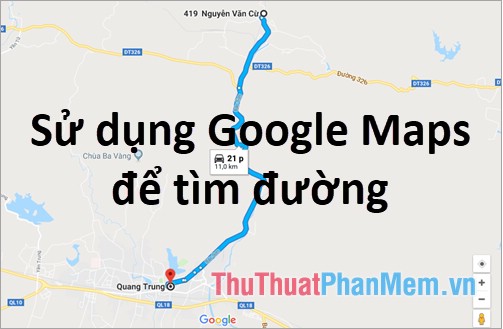
If you use Google Maps on your computer, you'll access the Google Maps page, and on your phone or tablet, use the Google Maps application.
Use Google Maps on a Computer
Step 1: Go to Google Maps page https://www. google. com/maps/ then log in to your Google account.
Step 2 : To find your way, select the directions icon  next to the search box of Google Maps.

Step 3 : Here you need to enter the starting point and destination in two boxes Select the starting point and Select destination , if you do not want to enter the location, you can choose the location directly on the map.

Once you have selected the location on the map, a green path will appear, the starting point is a dot, the destination is a red pin icon. On it will have the estimated time and length of the road.

You can choose the method to know how much time to travel: driving, public transport, walking, cycling, flying.
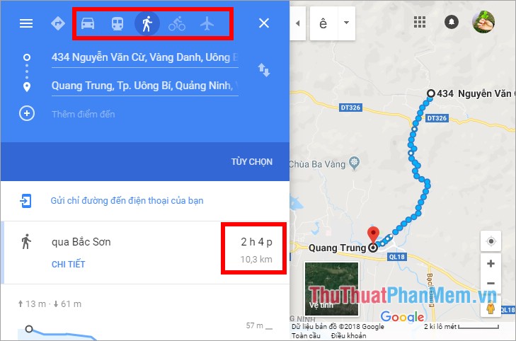
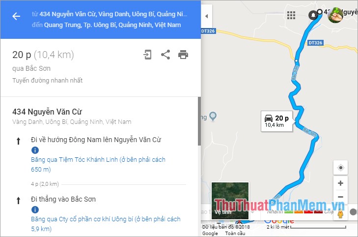
You can see the details of the route described by selecting DETAIL under the route.

Google Maps will give you detailed directions for easy navigation.
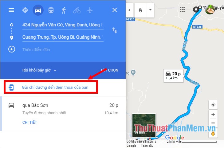
Step 4: After finding the way on the computer you can send directions to the phone by clicking Send directions to your phone and choosing how to send directions to the phone (via email or by phone) ).
Use Google Maps on Your Phone
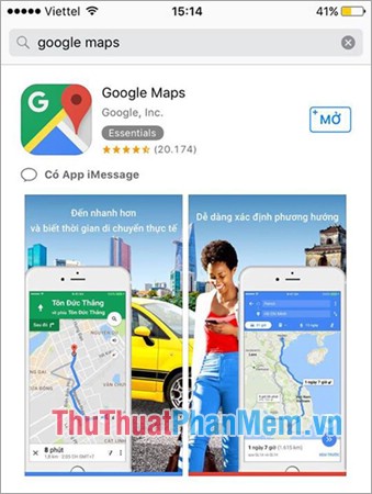
Step 1: Use on your phone you need to download or update to the latest version of Google Maps.
- On your Android device, go to CHPlay and search for the keyword Google Maps.
- On your iOS device, go to the App Store and download the Google Maps application.
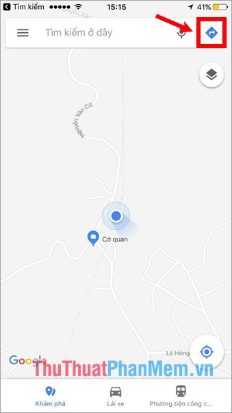
Step 2 : Open the Google Maps application you just downloaded / updated, on the interface with the blue dot icon in the middle of the screen is your current location. To find your way, select the icon  in the upper right of the search box.
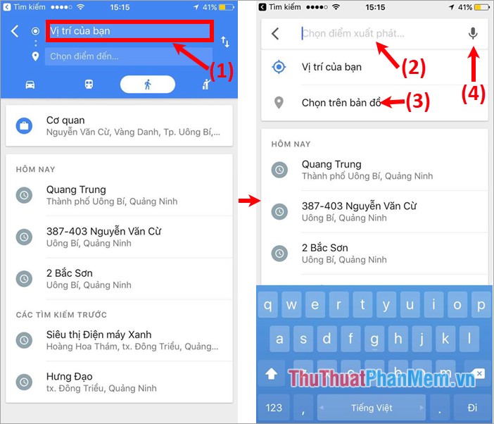
Step 3 : A new interface appears and you need to enter / select a starting point and enter / select the destination. First, click Your position (1) . The interface for entering the starting position can be entered directly in the white box (2) or you can click Select on the map (3) to select the location directly on the map. You can also search for voice by clicking the microphone icon (4) next to the location search box.
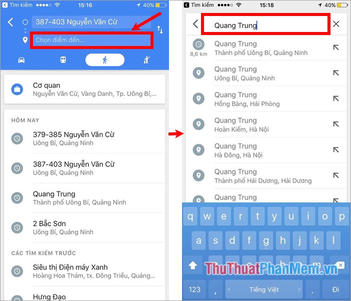
Next you choose Select destination and also enter the destination location or choose the destination directly on the map.
Step 4 : After you have selected, Google Maps will display the green path from the starting position (the blue dot position) to the destination (red pin icon) that you have entered, you will see the distance and time to ride a car.
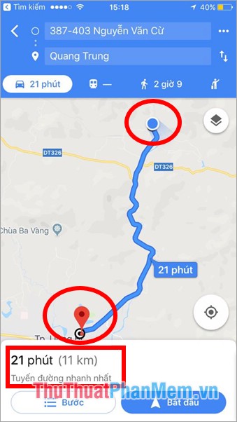
To change the method of moving you select on the other icons, you will also know the travel time by the method you choose, depending on the position that there are also methods that are not available.
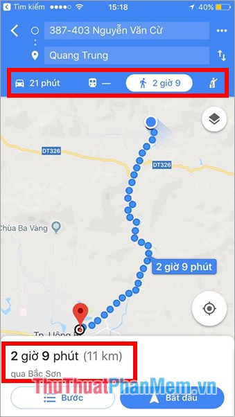
Step 5 : To view the list of directions, click the Step at the bottom to display the time and distance. To return to the map you select .

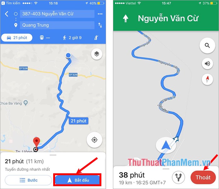
Step 6: To see the details of the route, and get the Vietnamese voice directions app, press Start at the bottom of the distance and time bar. Google Maps will guide you in detail throughout your travel route from start to destination. To finish you press the Exit red on the screen.
FAQ
What is the easiest way to Use Google Maps to Find Your Way?
Start with the requirements in this guide, then follow each step in order. Check the result after every major change so problems are easier to identify.
Can beginners follow these instructions?
Yes. The process is organized into practical steps, and you can repeat any step before moving forward.
What should I check if the method does not work?
Confirm your software or device version, permissions, settings, file format, and internet connection when the task depends on online services.
Related Articles
 How to Find Your Way with Google Maps on Your Phone5 minutes read
 How to Find the Way to Google Maps for Motorcycles5 minutes read
 Tips for Using Google Maps on Android11 minutes read
 How to View Older Street Images on Google Maps4 minutes read
 Instructions for Sending Google Maps Location on PC to Smartphone4 minutes read
 How to View the Elevation of a Location on Google Maps5 minutes read
Reader Comments 0
Sign in with email or Google to join the discussion.