How to Use Google Maps Immersive View on Android and iOS
Immersive View is a feature of Google Maps that helps you see a 3D model of a location even before you visit it in person. This feature uses Artificial Intelligence (AI) and Computer Vision to combine billions of aerial images and Street View to create a digital model of the world.
Google first announced Immersive View in 2022 but now, the mode is available in various locations such as London, New York, Tokyo, San Francisco, etc. Today's article will dive into how to use Google Maps' Immersive View feature, and the benefits when it becomes available.
How to use Immersive View in Google Maps
Google Maps is considered as the best navigation app thanks to its innovative features. And with the addition of Immersive View, you can now check live traffic, weather, air, and lighting conditions based on a specific time and date. Even better, you can see the layout of a place, look inside locations, and get a general sense of the size of a place before you even visit.
As of June 2023, you can use this feature in Los Angeles, New York City, San Francisco, Seattle, Las Vegas, Miami, Amsterdam, Dublin, Florence, Venice, Berlin, Paris, and Tokyo. You can expect more cities to be supported in the future as Google continues to roll out.
Follow the steps below to use Immersive View in locations where it is available:
1. Make sure you have the latest version of Google Maps from the Play Store or the App Store. This guide is valid for both Android and iOS devices.
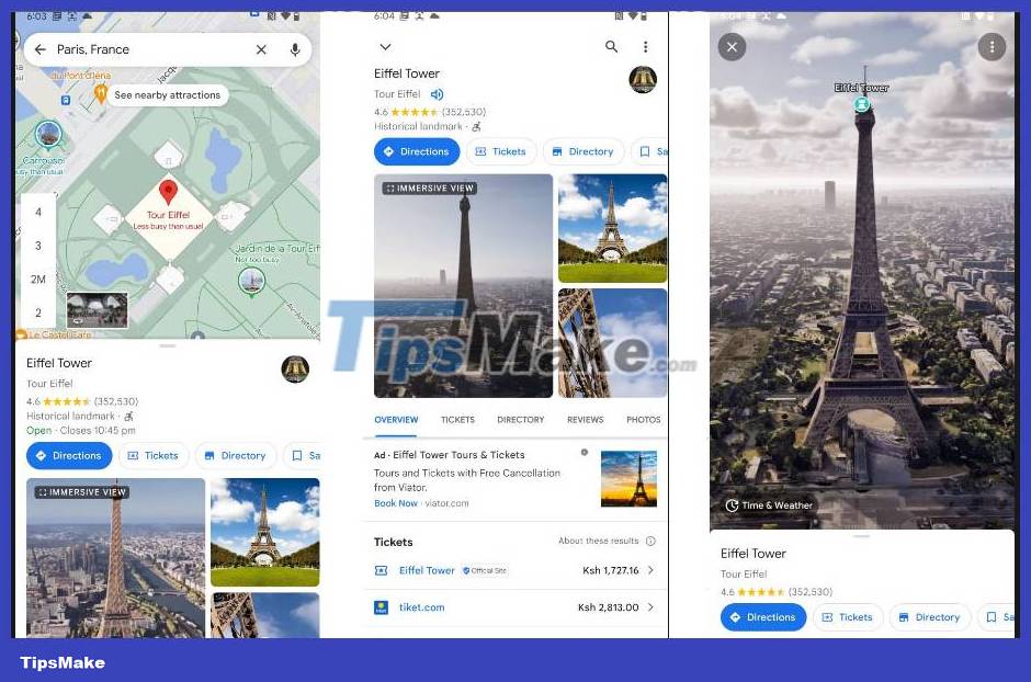
2. Launch the Google Maps app and search for a city that supports Immersive View. For example, Paris is used in this tutorial.

3. Touch the landmark icon on the map to display detailed information below the map. For example, the Eiffel Tower is the landmark in this case.
4. Under the Directions button, tap to open the Immersive View tab and tap it again on the next page.
5. Wait for the loading to complete and then you can explore the location by zooming in or out, single tap to zoom in on a specific place, or double tap to move to another area on the map.

6. If you want to check the weather for that location, tap the Time & Weather button on the map. You'll get the exact weather conditions at the time shown, and you can tap the time to choose a different day of the week. In addition, you can check how the weather changes on a particular day by sliding your finger on the timeline.

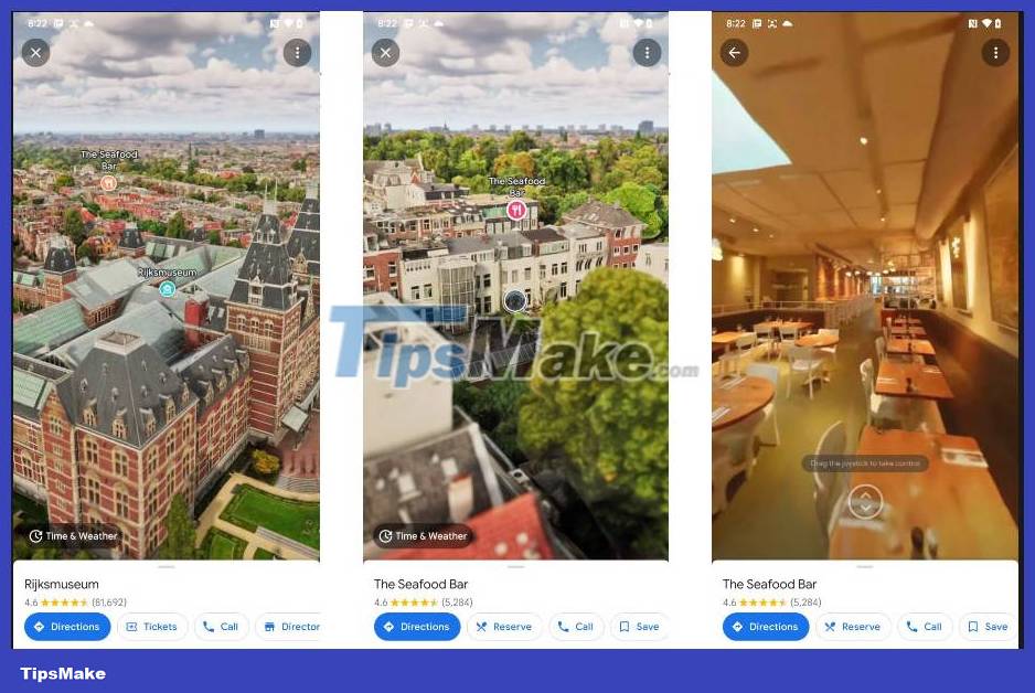
7. Additionally, some locations allow you to look inside locations and buildings. The example will use The Seafood Bar in Amsterdam. After entering Immersive View using the previous steps, tap the icon of the place you want to see inside. This will magnify the close-up view of the building.
8. If the place allows you to look inside, there will be a circular bubble below the location marker you pressed above. This bubble must not have an arrow inside to distinguish it from the Street View feature. Now tap the circular bubble to zoom in and see inside the building. You can use the on-screen joystick to control your movements.

You should read it
- ★ How to view Google Maps right on the iPhone lock screen
- ★ Google Maps new version on the computer officially launched
- ★ Google Maps has recorded 98% of human habitation on Earth
- ★ Google Maps deploys Live View - an augmented reality (AR) walk through the phone's rear camera
- ★ Google Street View adds 'time machine' feature