Google Maps has recorded 98% of human habitation on Earth
Street View captures images of more than 16 million kilometers of road (equivalent to 400 trips around the world) and nearly 100 million square kilometers of land in Google Earth..
Recently, Google has released extremely impressive figures that Street View cars have made over the past decade to serve Google Maps. 'Fleet' of Street View vehicles traveled globally to take photos for Google Maps. Specifically, Street View recorded images as more than 16 million kilometers of road (equivalent to 400 trips around the world) and nearly 100 million square kilometers of land in Google Earth, which shows that Google has captured 98% of the human habitation on Earth.

What Google does is truly remarkable and thanks to Google Earth we can travel around the world right in our room.
Nearly a decade ago (in 2004), Street View was invented by Larry Page, the co-founder of Google, when Apple launched a competitor to Google Maps.
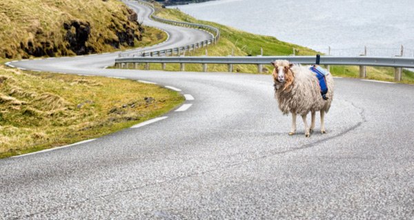
In addition to the fleet of cars with cameras, Google also uses pedestrians, even sheep and camels wearing cameras to reach places that vehicles cannot reach, to record 360-degree maps that users use the day. now on.
For a long time, Google Maps, with its very useful features, is now a popular digital map. However, many times Google Maps just misleading users into situations that make them cry.
- Google Maps has a built-in translation feature so you don't have to be confused when traveling abroad
- Google Maps adds a feature to report incidents on the road, warning areas where police shoot speed
- Directing too many lost travelers, Google Maps was 'boycotted' by an Italian town