Google Maps has supported navigation in Vietnam
The Google Maps system has supported navigation for mobile devices in Vietnam ...
The Google Maps system has supported navigation for mobile devices in Vietnam.
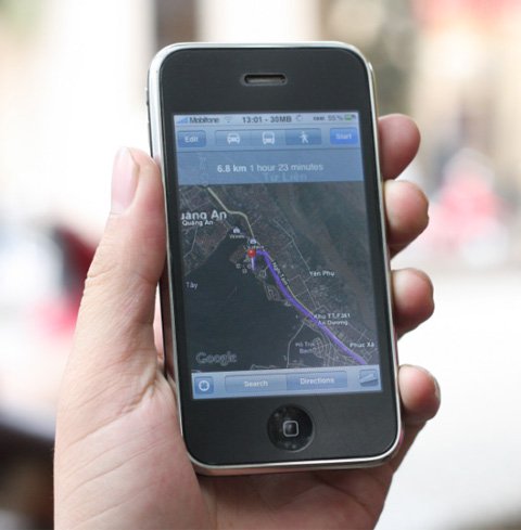
Navigation on Google Maps in Hanoi. Photo: Quoc Huy.
Tested on some smartphones running Symbian, iPhone, Windows Mobile . found the ability to get directions for Google Maps very well. Users can select the starting point, or right at the current standpoint (with the device with GPS wave), then select the destination.
Google Maps will indicate the length and the roads will pass through three vehicles: car, walk, and car. In particular, cars will not enter a one-way street, while large cars will limit urban revenues. At each section, the machine will automatically measure and notify the length, direction of the turn, as well as the name of the road displayed on the screen.
However, when using this navigation feature, the phone must always connect to the Internet (via 3G, EDGE, GPRS or Wi-Fi), by data maps and tools stored by Google on the server system , users can only operate in online mode.
In addition, some Google Maps paths are often farther away than in reality. However, with huge data and details of road systems in major cities in Vietnam, Google's support for navigation is good news for smartphone users and mobile phones that install Google Maps.
Some detailed pictures of Google Maps navigation in Hanoi, tested on iPhone 3GS.

Traveling from Nghia Tan to Long Bien by car .

. walking takes 2 hours 16 minutes.
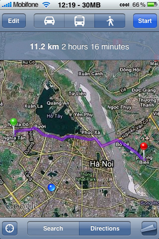
The shortest road does not allow the use of large cars.
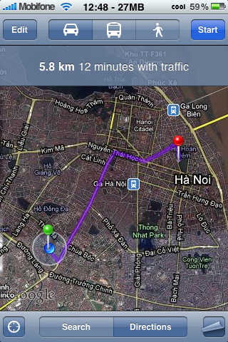 Leading the way from standing position (Thai T net) to Hoan Kiem Lake.
 Each road, the system will automatically report the number of long and turn units.
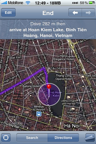
 In addition to satellite mode, Google Maps also supports normal map mode.

Go to the destination.
Was this article helpful?
Your feedback helps us improve.
Related Articles
 Good news: Google Maps has supported navigation for motorcycles in Vietnam2 minutes read
 8 reasons Google Maps is the best navigation app8 minutes read
 Google Maps on iOS has a navigation feature for motorcyclists in Vietnam2 minutes read
 5 applications to replace Google Maps in Vietnam5 minutes read
 How to find your way with Google Maps on your phone4 minutes read
 6 Google Maps Alternatives5 minutes read
Reader Comments 0
Sign in with email or Google to join the discussion.