Google Earth now has a time travel feature
Google Earth's mapping service will let Internet users dive into the world's oceans..
Table of Contents
Google Earth now lets you go back in time at street level, thanks to the launch of historic Street View imagery. The feature comes on the platform's 20th anniversary and brings new AI-powered tools to professional users (like urban planners) in the United States.
Explore the past in Google Earth
Google Earth has always helped people see the world from above. Now, it lets you see how streets and neighborhoods have changed over the years. With a new update, you can scroll through old Street View images right inside Google Earth. Want to revisit your childhood neighborhood or see how a city skyline has evolved? Just move the timeline slider and see what places looked like in the past.
Until now, historical Street View was only available in Google Maps and the Earth Pro desktop app. This update brings the feature to the main Google Earth app on web and mobile, making it easier for everyone to use.
Historic Street View imagery in Google Earth continues its popularity in Google Maps. The #somewhereonGoogleMaps trend has captured our nostalgia for places past and present. As Google Earth celebrates its 20th anniversary, it's time to look back at some of the company's key milestones.
Digital Time Machine for Us
The new Street View history feature turns Google Earth into more than just a virtual globe. It's now a visual time machine. You can trace your history or see how your favorite places have evolved. It's fascinating to see an empty lot become a playground or a quiet street transform into a bustling neighborhood.
For a long time, many people have enjoyed seeing a satellite view of their home using Google Earth.
Now, we can satisfy our curiosity about old places by going to places with a lot of historical records. For example, New York, London, and Paris, etc. Here are some favorite places that people have visited:
- Freedom Tower (One World Trade Center) in Lower Manhattan, New York City: You can see a piece of modern American history as this iconic structure rises from the reconstruction efforts at Ground Zero.
- The Berlin Wall in Germany is one of the most historically significant timelapse images. See the fall of the Berlin Wall, along with the massive urban transformation that followed German reunification.
- The Kennedy Space Center in Florida offers a comprehensive history of NASA's launch facilities and the development of the space program's infrastructure. If you're a space enthusiast, you can visit SpaceX Starbase in Texas to see the company's rapid rise.
- Pompeii, Italy and many ancient Roman attractions such as the Rectangle Theatre, Pompeii Theatre, Temple of Apollo, Arch of Tiberius and Public Square.
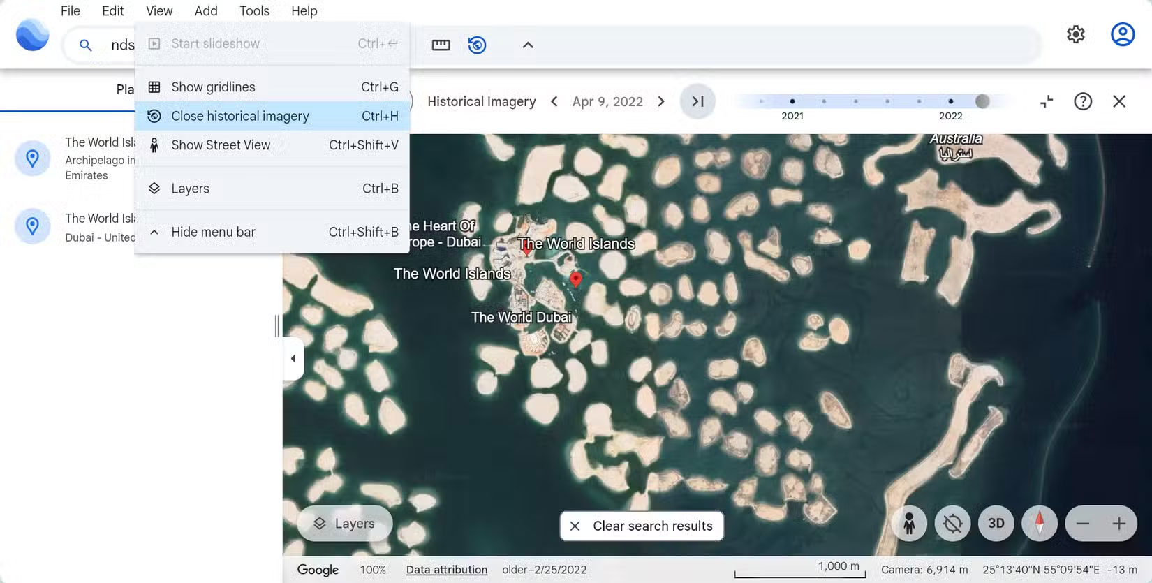
- The World Islands in Dubai, United Arab Emirates , are artificial islands built to resemble a world map.
Smarter maps for real-world problems
It's not all nostalgia and fun. Along with the time travel feature, Google is adding powerful new tools for U.S. professionals. Soon, planners and researchers will see overlays showing tree canopy cover and ground surface temperature. These AI-powered insights could help cities plan for more green space or address 'urban heat islands,' where temperatures rise due to lack of trees and too much concrete.
For decision makers, knowing where trees are lacking or where temperatures are spiking can guide smart choices. They can plant more trees in the hottest areas or design new parks where trees are needed most. These upgrades can help make cities cooler, greener, and more comfortable for everyone.
Was this article helpful?
Your feedback helps us improve.
Related Articles
 Time travel guide right on Google Earth2 minutes read
 Interesting photos from Google Earth3 minutes read
 What happens when you travel through the heart of the earth?1 minutes read
 Google Earth takes tourists to visit ancient Rome3 minutes read
 5 ways to travel smarter with Google AI: Planning, booking, language translation…5 minutes read
 It takes hundreds of thousands of years for light to travel from the center of the Sun to Earth?1 minutes read
Reader Comments 0
Sign in with email or Google to join the discussion.