This is the most detailed map of the seafloor ever made.
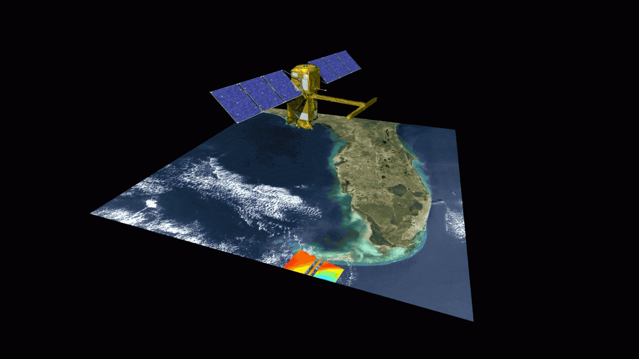
A satellite developed by NASA and CNES has provided detailed information about the seafloor with unprecedented precision.
The ocean still holds many secrets to discover. Despite significant advances in technology, the ocean's surface remains less well known than the surface of the Moon. That's why the NASA-CNES SWOT (surface water and ocean topography) satellite is so interesting.
SWOT completed its seafloor mapping in just one year after launching in December 2022. The map has a resolution of 8 km, surpassing 30 years of data from previous satellites. Researchers discovered 'thousands of abyssal hills and underwater volcanoes' that had never been recorded before.
Previously, most underwater surveys relied on satellite altimetry, which infers seafloor topography from variations in ocean surface elevation. Seamounts, for example, alter local gravity, causing water to accumulate above them. However, SWOT improves on this technique by measuring variations in two dimensions, which can help distinguish previously unknown geological structures.

Was this article helpful?
Your feedback helps us improve.
Related Articles
 The mystery of the 'kiss of death' of the big-mouthed fish, which opens its mouth 4 times wider each time it fights2 minutes read
 Comparing AirTag 2 and AirTag 1: What upgrades has Apple made after 4 years?6 minutes read
 3 minutes of film made with AI technology makes Japanese anime industry scared3 minutes read
 10 'unwritten' principles of self-made millionaires10 minutes read
 Instructions on Importing Pre-Made Templates into Workspace on n8n6 minutes read
 Stunned with iPhone Xs for nearly 70 billion VND made of meteors3 minutes read
Reader Comments 0
Sign in with email or Google to join the discussion.