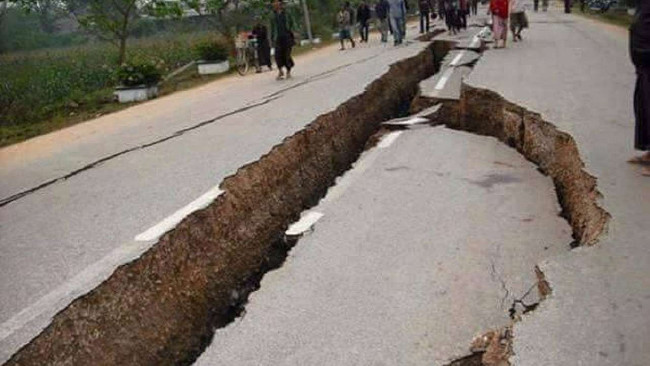
Asian regional mapping scientists are prone to earthquakes in the hope of mitigating natural disasters
An international team of scientists is expected to begin a four-year project starting this month to map, image and monitor earthquake-prone areas, including some remote areas. sticky and densely populated in Asia.
This $ 7 million project is led by Michael Steckler, a professor at Columbia University's Lamont-Doherty Earth Observatory. It will include three teams of global positioning system stations and more than 100 seismic detectors that will detect tremors in Bangladesh and western Myanmar, along the region called the IndoBurma amplification region.

A group in India will also start working in the region that extends into the Northeast of that country. Steckler told the Thomson Reuters Foundation that this particular area has never been compared, studied in any such research.
More than 30 researchers from at least six countries will create a detailed picture of the recessed area stretching over an area of about 700 km (435 miles) and an extension of the area that caused waves. The 2004 Indian god in the Indian Ocean took away the lives of more than 200,000 people.
Any future earthquake in the surrounding areas could affect 140 million people - among them the poorest people in the world - and caused the collapse of thousands of buildings. Steckler cited the Rana Plaza disaster in Bangladesh, killing more than 1,100 factory workers in 2013, as an example of the potential risks an earthquake will cause.
According to preliminary work done late last year, Steckler and his team will move one more 1 ton of equipment and tools to a facility outside the capital of Bangladesh, Dhaka, later this month. The work will then be carried out in northeastern Bangladesh. Teams in both India and Myanmar will start working in March.
In addition to applying seismic measurement, researchers will conduct various studies, collect and study rock samples in all three countries to better understand and minimize the risks that any dynamic Large future land will occur for the survey area. It is also hoped that the research will allow authorities to raise awareness about earthquakes and develop the most effective ways to keep buildings and communities safer, Steckler said.
According to Vineet Gahalaut, director of the National Seismic Center in New Delhi: "These initiatives are essential in the region, one of the poorest and most densely populated countries in the world ."
See more:
- Marvel at the strange mysteries found after floods and storms
- American scientist proposed the idea of destroying super typhoons with nuclear bombs
- Decode the secrets of the dragon faucet, scary natural phenomenon
You should read it
- ★ Technological things that consider earthquakes are small
- ★ How to survive when an earthquake occurs?
- ★ What are the special houses for millions of dollars built to deal with the end of the world?
- ★ Warning: in 2018 there will be 20 extremely serious earthquakes occurring because the Earth is slowing down
- ★ Can a catastrophic series of earthquakes be in this August?